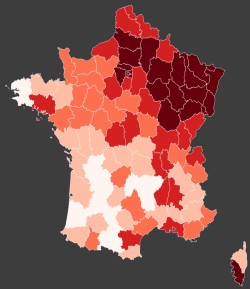
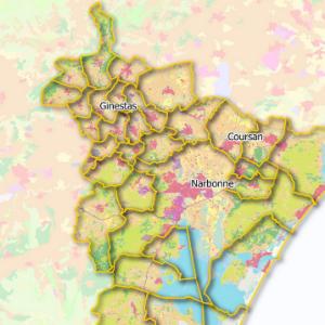
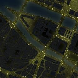
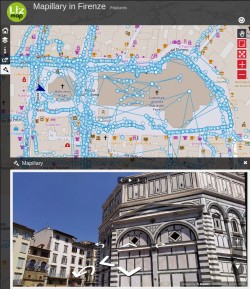
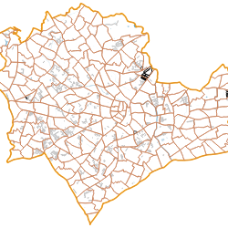
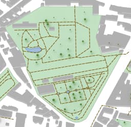
Some projects showing some specific features of Lizmap.
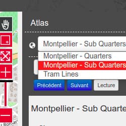
Some modules also exists, to add some specific features in Lizmap :
Features
-
Cats movements - Dataviz
Abstract : Data from https://movebank.org (Creative Commons licence). Images from http://cattracker.org
Keyword list : Cats, USA, demo, GPS, stats, dataviz
Projection : EPSG:4326
Bounding Box : -73.91562537700283997, 40.43006121583411527, -72.83265537700282266, 41.41402264844487036
Cats movements - Dataviz
Load the map
View metadata
- Illustration

- Title
- Cats movements - Dataviz
- Abstract
- Data from https://movebank.org (Creative Commons licence). Images from http://cattracker.org
- Projection
- EPSG:4326
- Bounding Box
- -73.91562537700283997, 40.43006121583411527, -72.83265537700282266, 41.41402264844487036
- Web Map Service
- WMS Url
- WMTS Url
-
Évolution du COVID-19 en France
Abstract : Sources des données COVID-19: https://github.com/opencovid19-fr/
Source des données spatiales:...
Keyword list :
Projection : EPSG:3857
Bounding Box : -7208019.21990237850695848, -4193672.97351285442709923, 6543118.98985906597226858, 8392358.3377227783203125
Évolution du COVID-19 en France
Load the map
View metadata
- Illustration

- Title
- Évolution du COVID-19 en France
- Abstract
- Sources des données COVID-19: https://github.com/opencovid19-fr/
Source des données spatiales: https://github.com/gregoiredavid/france-geojson/
Licence ouverte LO
- Projection
- EPSG:3857
- Bounding Box
- -7208019.21990237850695848, -4193672.97351285442709923, 6543118.98985906597226858, 8392358.3377227783203125
- Web Map Service
- WMS Url
- WMTS Url
-
Draw on the map - Drawing tool
Abstract : In this project you can draw with the new drawing feature. After you can export or import your...
Keyword list : draw, import, export
Projection : EPSG:3857
Bounding Box : -16738278.35044224932789803, -2054742.57886634720489383, -16559176.13488828390836716, -1937744.30952495010569692
Draw on the map - Drawing tool
Load the map
View metadata
- Illustration

- Title
- Draw on the map - Drawing tool
- Abstract
- In this project you can draw with the new drawing feature. After you can export or import your file. Authorized extensions: GeoJson, GPX or KML
- Projection
- EPSG:3857
- Bounding Box
- -16738278.35044224932789803, -2054742.57886634720489383, -16559176.13488828390836716, -1937744.30952495010569692
- Web Map Service
- WMS Url
- WMTS Url
-
Expression and rendering
Abstract : This map shows how to use some QGIS expressions to change the rendering of the map dynamically....
Keyword list :
Projection : EPSG:4326
Bounding Box : 5.5148107237624906, 35.71464487651629582, 20.30663161820922014, 48.25583124440192506
Expression and rendering
Load the map
View metadata
- Illustration

- Title
- Expression and rendering
- Abstract
- This map shows how to use some QGIS expressions to change the rendering of the map dynamically.
This project is an idea from Totò Fiandaca on Twitter
- Projection
- EPSG:4326
- Bounding Box
- 5.5148107237624906, 35.71464487651629582, 20.30663161820922014, 48.25583124440192506
- Web Map Service
- WMS Url
- WMTS Url
-
Action and SQL
Abstract : This demo shows you an example of Lizmap Actions.
A SQL query can be performed when clicking on...
Keyword list : sql, action, postgresql
Projection : EPSG:3857
Bounding Box : 374297.39412058558082208, 5403132.95489238761365414, 390804.89069716754602268, 5414272.04712011478841305
Action and SQL
Load the map
View metadata
- Illustration

- Title
- Action and SQL
- Abstract
- This demo shows you an example of Lizmap Actions.
A SQL query can be performed when clicking on a fire hydrant and then clicking on the "house" icon.
The query will execute a 150 meters buffer. As a result of the action, all buildings intersecting the buffer are selected.
Another SQL query can be executed to find the closest fire station.
- Projection
- EPSG:3857
- Bounding Box
- 374297.39412058558082208, 5403132.95489238761365414, 390804.89069716754602268, 5414272.04712011478841305
- Web Map Service
- WMS Url
- WMTS Url
-
Landuse in Narbonne, South of France
Abstract : This map shows the landuse in South of France
Data from OpenData du Grand Narbonne, en liccense...
Keyword list :
Projection : EPSG:2154
Bounding Box : 700665.08580000000074506, 6225961.72759999986737967, 721239.89839999994728714, 6245895.51599999982863665
Landuse in Narbonne, South of France
Load the map
View metadata
- Illustration

- Title
- Landuse in Narbonne, South of France
- Abstract
- This map shows the landuse in South of France
Data from OpenData du Grand Narbonne, en liccense ouverte (LO)
Project from

- Projection
- EPSG:2154
- Bounding Box
- 700665.08580000000074506, 6225961.72759999986737967, 721239.89839999994728714, 6245895.51599999982863665
- Web Map Service
- WMS Url
- WMTS Url
-
Tram in Montpellier
Abstract : This project is to show the atlas feature. Now we can make many atlas in one project.
Keyword list :
Projection : EPSG:2154
Bounding Box : 762338.2973799524, 6272440.179288556, 780436.5784388853, 6286965.718922096
Tram in Montpellier
Load the map
View metadata
- Illustration

- Title
- Tram in Montpellier
- Abstract
- This project is to show the atlas feature. Now we can make many atlas in one project.
- Projection
- EPSG:2154
- Bounding Box
- 762338.2973799524, 6272440.179288556, 780436.5784388853, 6286965.718922096
- Web Map Service
- WMS Url
- WMTS Url
-
Fauna observations in Polynesia - Editing tool
Abstract : This project shows the possibility of editing Lizmap data, through an example of collecting...
Keyword list :
Projection : EPSG:3857
Bounding Box : -16760892.01575333997607231, -2089232.04093316150829196, -16508346.60789945349097252, -1914178.49111832631751895
Fauna observations in Polynesia - Editing tool
Load the map
View metadata
- Illustration

- Title
- Fauna observations in Polynesia - Editing tool
- Abstract
- This project shows the possibility of editing Lizmap data, through an example of collecting observations of marine mammals and turtles in Polynesia.
To add an observation, click on the "notepad" icon in the left menu bar, then on the "Add" button. Fill out the form (you can test sending photos), click on the map to position the observation, and save.
A click on one of the points of the map shows the linked data, and the photo if it exists.
You can display the observation data table via the "Data" menu (last icon on the left menu bar).
- Projection
- EPSG:3857
- Bounding Box
- -16760892.01575333997607231, -2089232.04093316150829196, -16508346.60789945349097252, -1914178.49111832631751895
- Web Map Service
- WMS Url
- WMTS Url
-
Snapping tool
Abstract : When you add a point in the point layer, on the top of the editing form, you have a button...
Keyword list :
Projection : EPSG:3857
Bounding Box : 443843.54014706803718582, 5405836.9861158886924386, 446019.38411142135737464, 5407424.25399209279567003
Snapping tool
Load the map
View metadata
- Illustration

- Title
- Snapping tool
- Abstract
- When you add a point in the point layer, on the top of the editing form, you have a button "digitization". Click on it and you can start/stop to snap your point with the road layer.
- Projection
- EPSG:3857
- Bounding Box
- 443843.54014706803718582, 5405836.9861158886924386, 446019.38411142135737464, 5407424.25399209279567003
- Web Map Service
- WMS Url
- WMTS Url
-
Earthquakes ≥ 4 MMI in Indonesia in 2020
Abstract : Using the time manager tool, you can filter a layer by date and move backward and forward in...
Keyword list :
Projection : EPSG:4326
Bounding Box : 90.17010169057451208, -17.8018876074478527, 146.14245085744417452, 14.86800360751617944
Earthquakes ≥ 4 MMI in Indonesia in 2020
Load the map
View metadata
- Illustration

- Title
- Earthquakes ≥ 4 MMI in Indonesia in 2020
- Abstract
- Using the time manager tool, you can filter a layer by date and move backward and forward in time. The dataviz will follow data displayed in the map. Picture from USGS, via Wikimedia Commons
- Projection
- EPSG:4326
- Bounding Box
- 90.17010169057451208, -17.8018876074478527, 146.14245085744417452, 14.86800360751617944
- Web Map Service
- WMS Url
- WMTS Url
Javascript
-
Paris by night - Adding javascript, user interface customization
Abstract : This project shows the elements of public lighting in the center of Paris.
It shows the...
Keyword list :
Projection : EPSG:2154
Bounding Box : 650274.09081319929100573, 6860137.21290676575154066, 654065.9612267006887123, 6862910.45974645391106606
Paris by night - Adding javascript, user interface customization
Load the map
View metadata
- Illustration

- Title
- Paris by night - Adding javascript, user interface customization
- Abstract
- This project shows the elements of public lighting in the center of Paris.
It shows the rendering possibilities of QGIS with free data. You can change the scale by double clicking on the map or using the navigation tools (on the right)
A click on the map displays the corresponding data under the click (streetlights)
Data: OpenData of the city of Paris && OpenStreetMap
- Projection
- EPSG:2154
- Bounding Box
- 650274.09081319929100573, 6860137.21290676575154066, 654065.9612267006887123, 6862910.45974645391106606
- Web Map Service
- WMS Url
- WMTS Url
-
Mapillary in Firenze
Abstract : This map uses a script to add a Mapillary viewer in the main interface. The script is available...
Keyword list : mapillary, street view, firenze
Projection : EPSG:3857
Bounding Box : 1252133.32590221147984266, 5429349.91738397814333439, 1253488.26932425191625953, 5430634.05945917032659054
Mapillary in Firenze
Load the map
View metadata
- Illustration

- Title
- Mapillary in Firenze
- Abstract
- This map uses a script to add a Mapillary viewer in the main interface. The script is available on the JavaScript library.
To start click on the blue layer appearing. Street view will appear corresponding to the coordinate of the arrow symbol on the map.
- Projection
- EPSG:3857
- Bounding Box
- 1252133.32590221147984266, 5429349.91738397814333439, 1253488.26932425191625953, 5430634.05945917032659054
- Web Map Service
- WMS Url
- WMTS Url
Miscellaneous
-
Cadastre EDIGeo Montpellier with FlatGeobuf
Abstract : This project has been build to test FlatGeobuf.
The data has been downloaded from French Plan...
Keyword list :
Projection : EPSG:2154
Bounding Box : 762035, 6274310, 779140, 6284440
Cadastre EDIGeo Montpellier with FlatGeobuf
Load the map
View metadata
-
QGIS Information
Abstract :
Keyword list :
Projection : EPSG:4326
Bounding Box : -179, -89, 179, 89
QGIS Information
Load the map
View metadata
- Illustration

- Title
- QGIS Information
- Abstract
-
- Projection
- EPSG:4326
- Bounding Box
- -179, -89, 179, 89
- Web Map Service
- WMS Url
- WMTS Url
Modules
-
PgMetadata demo
Abstract :
Keyword list :
Projection : EPSG:4326
Bounding Box : 3.8665670972281756, 43.60787634971424609, 3.87873159460366246, 43.61985948078168462
PgMetadata demo
Load the map
View metadata
- Illustration

- Title
- PgMetadata demo
- Abstract
-
- Projection
- EPSG:4326
- Bounding Box
- 3.8665670972281756, 43.60787634971424609, 3.87873159460366246, 43.61985948078168462
- Web Map Service
- WMS Url
- WMTS Url
-
PgRouting
Abstract : This project is showing the PgRouting for Lizmap Web Client.
It needs the PgRouting extension...
Keyword list : routing, postgresql
Projection : EPSG:2154
Bounding Box : 828027.19229999999515712, 6287270.73209999967366457, 832571.89639999996870756, 6290154.55339999962598085
PgRouting
Load the map
View metadata
- Illustration

- Title
- PgRouting
- Abstract
- This project is showing the PgRouting for Lizmap Web Client.
It needs the PgRouting extension installed on the PostgreSQL database.
- Projection
- EPSG:2154
- Bounding Box
- 828027.19229999999515712, 6287270.73209999967366457, 832571.89639999996870756, 6290154.55339999962598085
- Web Map Service
- WMS Url
- WMTS Url