Fond de carte

- Titre
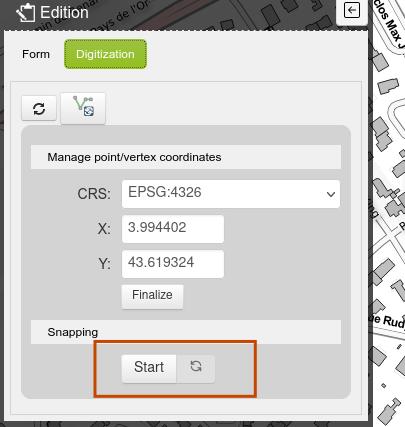
- Snapping tool
- Description
- When you add a point in the point layer, on the top of the editing form, you have a button "digitization". Click on it and you can start/stop to snap your point with the road layer.
- Structure
- 3liz
- Personne
- 3liz
- Courriel
- info (at) 3liz.com
- Site internet
- http://www.3liz.com/lizmap.html
- Projection
- EPSG:3857
- Emprise
- 443843.54014706803718582, 5405836.9861158886924386, 446019.38411142135737464, 5407424.25399209279567003
- Service WMS
- WMS URL
- WMTS URL
- WFS URL
Édition
Édition
Choisir un traitement à effectuer
